On a surface parking lot in Deep Ellum, you might hit limestone at eight feet. Two miles west near the Trinity River, you find forty feet of fat clay before reaching bedrock. Dallas packs extreme geotechnical variety into a single city grid, and that means a generic monitoring plan falls apart fast. We learned this the hard way on a mixed-use dig off Mockingbird Lane where the Eagle Ford shale weathered differently on each corner of the site. The instrumentation package that works in the Austin Chalk outcrops of Oak Cliff won't capture the consolidation settlement happening over in the Blackland Prairie soils of Richardson. Getting the data right starts with recognizing which Dallas you're digging in. When the stratigraphy shifts every few hundred feet, we combine inclinometer arrays with real-time deep excavation monitoring to flag movements before they reach the sidewalk.
Dallas soils can change from limestone to fat clay in under a mile. Thresholds that work in one neighborhood won't protect the next.
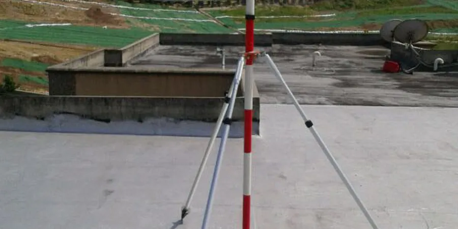
Methodology and scope
Local considerations
On a 40-foot cut through the Grayson Marl near the Medical District, the shoring looked stable for three weeks, then cracks appeared overnight after a two-inch rain. The issue wasn't the wall design; it was a perched water lens in the overlying terrace deposits that nobody had detected during the site investigation. That's the kind of thing that keeps a technician awake. Monitoring isn't a checkbox for the building permit; it's the feedback loop that tells you whether your excavation support assumptions are holding up. When the data starts drifting, the crew adjusts tieback tension or adds a wale level before the inspector even asks. Our approach puts the engineer of record in the loop with daily plots, not a monthly summary, because in the expansive soils of Dallas County, a week of deferred maintenance on a monitoring program can erase the factor of safety.
Applicable standards
IBC Chapter 33 – Safeguards During Construction, ASTM D7299 – Standard Practice for Verifying Performance of Vertical Inclinometer Probes, FHWA-NHI-10-024 – Earth Retaining Structures and Ground Improvement
Associated technical services
Shoring Performance Monitoring
Inclinometers, tiltmeters, and automated total station arrays installed on soldier pile, secant, and soil nail walls to track lateral deflection and rotation against IBC-specified tolerances.
Adjacent Settlement & Crack Surveys
Pre-construction condition surveys with optical crack gauges and settlement points on structures within the zone of influence, updated daily during active excavation phases.
Groundwater & Pore Pressure Monitoring
Vibrating wire piezometers and observation wells installed behind the shoring to measure groundwater response during dewatering and storm events, critical for the expansive clay formations common in Dallas County.
Typical parameters
Frequently asked questions
How much does excavation monitoring cost in Dallas?
A basic package with four inclinometer casings, six settlement points, and two piezometers typically runs between US$890 and US$2,790 for a single month of monitoring, depending on how close adjacent structures are and how often the data needs to be collected. Projects within the DART corridor or near historic masonry buildings in areas like Deep Ellum tend toward the higher end because they require tighter instrumentation density and more frequent readings.
What kind of instruments do you use?
We stick with proven vibrating wire and MEMS-based instruments. The inclinometers are typically digitilt or similar biaxial probes, the piezometers use Geokon or RST vibrating wire transducers, and the total stations are Leica or Trimble robotic units. Everything gets calibrated against a NIST-traceable standard before it leaves the shop.
How fast can you respond if the readings start moving?
Our system sends SMS and email alerts within 90 seconds of a threshold breach. The technician on call reviews the data immediately and calls the engineer of record to discuss whether the movement is a transient event like a temperature spike or a real trend that needs shoring adjustments before the next shift starts.
Do you handle the monitoring for the entire duration of the excavation?
Yes. We typically mobilize instruments before the first bucket of soil comes out and stay on site through final backfill and compaction. The critical period is usually the first two weeks after each bench is cut, but we maintain the full array until the permanent structure provides lateral restraint.